NOTE: Please read Parts I and II if you haven’t yet done so, then return here to complete the series.
When I first began this exploration as a Covid-driven hobby, I looked at maps of Scotland, tracing possible routes from Glencoe to Aboyne that generally avoided what I assumed to be a pure no-man’s land of mountain wilderness. These routes seemed impossibly long and brutal for 1692, and led me to seriously doubt our family’s origin tale was much more than a fable.
Seen now through a lens of deep research, my first doubts can be characterized, at best, as naive. In this third installment on the theoretical migration from Glencoe to Aboyne, we can demonstrate it is not only not impossible, it is actually a plausible scenario.
Working backward in time through our study of the descendancy Peter Cromar 1690, researchers have unearthed three independent instances of an oral history that theorize this origin might be Glencoe — but then we collectively hit the wall. Working now instead forward in time from a deep investigation of the Massacre of Glencoe in part I of this series, we’ve continued a general study of the circumstances and means of survival available in the late 17th century in the Highlands in part II. With the resources and clues provided there, we’ll combine historical material with images and Google Maps Street View to create a virtual migration path.
Is this really plausible?
When I first had the thought to test this, I dismissed it as an effort leading to fantasy. Sure, I could make up a route and maybe it’s as good as any other route, or maybe not, so what can it prove? Deep investigation — from politics to clan relationships, geography to weather, survival gear to infrastructure — has convinced me this is no longer an exercise in arbitrariness or futility, but an important piece of the puzzle that might eventually connect Peter to Glencoe. This investigation reveals:
- These were tough Highlanders who lived with the land, traveled light, and had the strength, tactics, clothing, and gear to survive sustained exposure to a harsh environment — if given time enough to prepare an escape.
- Some soldiers hinted warnings prior to the Massacre, which may have given some of these Highland hosts that time.
- Escape tracks to the south could lead to shelter, and from there, a migratory route.
- Such a migratory route could avoid threats — government forces to the north, rival clans to the south — by heading generally east.
- Following footpaths, rivers, lochs, and drove roads, a migratory route leading to Aboyne around 120 miles in length can be found snaking through the Highlands.
Comparison with a precedent
That last point feels fantastical again, especially when one factors in carrying a toddler along strapped to one’s back. But we do well to remember: the record of the Massacre clearly documents Alasdair Ruadh MacIain, chief of the MacDonalds of Glencoe, walking first about 17 miles to Fort William in 2 days, then forced to turn around and walk about 60 miles to Inverary at an urgent pace in about 3 days, then walking home again, another 45 miles. MacIain — not a young man, mind you — walked about 120 miles over the course of 8 travel days interspersed with delays either being harassed by troops or waiting for lolly-gagging officialdom. This amounts to an average of 15 miles per day — and in one urgent 3-day stretch, he’s clocking in at 20 miles per day. All this with scant winter daylight, brutal cold, and snow-clogged pathways!
To make this comparison perfectly clear: MacIain’s pre-Massacre journey to swear his feckless oath to William is as long as a hypothetical hike from MacDonald country to Aboyne.
Parameters for time
So, within the limits imposed by extreme geography, dangerous weather, limited preparation time, dicey travel infrastructure, unfriendly clan rivalries, and genocidal government foes, can we assume a 15-mile-per-day pace for our refugees? According to Canberk Koksal at Outdoor Crunch there is a way to factor time and distance with circumstance:
Average hiking speed is 2.5 mph (1.4 m/s = 5 km/h) as explained above, but William Naismith, a Scottish mountaineer, came up with a generally accepted formula for calculating hiking speed on a slope, assuming an average fitness level:
1 hour for every 3 miles, plus 1 hour for every 2000 feet of ascent
So, if you’re going for a 6 mile round-trip hike, with 1000 feet of elevation gain, then the hike would take approximately 2.5 hours to complete. Some people also correct Naismith’s rule for descent, adding 10 minutes for every 1000 ft of gentle downhill while losing 10 minutes for 1000 ft of descent.
Lower the pace by a 1/2 mph to account for challenging terrain. Uneven terrain, such as a rocky mountainside path will slow your pace more than a wide, well-groomed trail. Hiking at night or in bad weather conditions also slows down hiking pace. Assume you will take 25% longer to walk a mile in poor weather. In extreme conditions, increase this to 50%. Backpacking adds an additional load to consider, as hiking with a heavy pack can slow you down. While this will vary from person to person, very roughly speaking, you can reduce your miles per hour by a 0.2-0.5 miles when carrying a heavy backpack.
Canberk Koksal
Every hardship Canberk mentions that might slow one down — bad terrain, poor weather, carrying a load, even perhaps walking at night — are present in this theoretical migration. So to calculate the time this would take:
- Assuming the ideal rate of 2.5 mph, we’ll factor —0.5 mph for portage, with a bairn being carried along with survival gear. On level terrain, the refugees can walk 2 mph. We’ll call this RATE 1 on portions of the journey that fit the most ideal conditions.
- Factor Rate 1 for poor terrain: this would include extreme stretches like the 15 mile path through boggy Rannoch Moor or the 20 mile distance on the Glenshee Road from Enochdhu to Braemar. About a third of our distance is extreme terrain, creating a 1.5 mph pace we’ll call RATE 2.
- Factor Rate 1 for poor weather: this would include walking through, or in the immediate aftermath of, blizzard conditions reported on the day of the Massacre. Refugees are walking at little more than 1 mph in the stretch from their home to a place of shelter, for example Dalness or Inverellan. We’ll call this slowest pace RATE 3. About 10% of our distance may account for the slowest rate of travel.
The migration
Here we present our theoretical migration:
We visualize this as having four stages:
- The escape (light red lines)
- The western stage (light orange lines)
- The turn north (light green lines)
- The eastern stage (light violet lines)
Each stage is broken down into legs which represent one travel day, and correspond with descriptions below. Along the way are places of shelter: RED pins represent hypothetical stops, BLUE pins represent alternative stops. Below, we’ll describe each stage, leg, and stop, embellished with virtual walking paths courtesy of Google Maps Street View. Just click to walk along the path and experience the terrain, if not the weather.
Stage 1: The escape
We’ll assume the following escape parameters for a small group of refugees to establish average time and distance parameters.
Night 0
- The refugees | This may be a family group, including a 16 month old Peter Cromar, though not yet known by that name. As tenants or subtenants, they are related to MacIain, though more likely known by a surname like Culp, Henderson or any of the other septs associated with MacDonald of Glencoe. There is oral history that suggests brothers are traveling in this group, so an unknown uncle may be part of the pack. My unknown 7th great-grandparents have heeded a hinted warning dropped before the Massacre and have prepared clothing and gear to get out of Glencoe, possibly planning never to return, though this option may not occur to them until they either witness the atrocity from afar or hear rumor of its scope.
- 12 Feb evening: Auchnacoan to Gleann Leac na Muidhe | This represents a theoretical escape from the more settled areas of the Glen, and is the most conjectural portion of the theory: there are so many options for speculation, and we have no criteria for preference, so we’ll use Auchnacoan for the sake of argument, since it is mid-way between Carnoch and Achtriachtan. From Auchnacoan, a path up to MacIain’s hidden summer settlement at Gleann Leac na Muidhe gives the refugees overnight shelter and time to plan. At a distance over a little more than a mile, assume our slowest rate for night travel with no moon under cloudy skies heavy with the next day’s blizzards: Rate 3, 1 hour of travel time.
Day 1
- 13 Feb: Gleann Leac na Muidhe to Inverellan | From here there several potential routes under blizzard conditions, described from west to east:
- Continuing south-west down the glen, refugees might reach Corphin, a possible Stewart settlement. If we assume Corphin as most likely because least difficult, it would likely add a day to the migration as it’s so far west.
- Turning south-east to Fionn Ghleann and aiming for the 1800 foot elevation pass to the west of Beinn Maol Chaluim, and continuing down to Invercharnan, a possible Campbell holding (a rival yes, but we know some Campbells gave shelter to victims).
- Lastly, from Fionn Ghleann to a pass at the 2100 foot elevation to the north of Beinn Maol Chaluim, down to Gleann Fhaolain and finally to Inverellan, where that glen intersects with Glen Etive. Dalness is another possible refuge in the area along this route.
- Since we have no other basis for preference, we’re using the path to Inverellan or Dalness, even though this is the most difficult, if for no other purpose than to pin-drop a point situated on an easterly route. This establishes a distance of approximately 4 miles, the harshest of travel conditions with upwards of a 2000 foot ascent and descent, possibly during snowfall. Our slowest Rate 3 applies, so assume 4 hours of travel time from shelter to shelter.
Day 2
- 14 Feb: Inverellan to Rannoch Moor frontier | From Inverellan, we find a route up Glen Etive to the frontier of Rannoch Moor, possibly as far north as the area now occupied by Kingshouse (which does not exist in 1692), possibly as far south as the site of the MacDonald summer shielings. To avoid running across troops they were dodging, we might want to assume the refugees were attempting to keep as far south as the bogs allow, but paths closer to the north shore of Loch Ba seem nonexistent. Some candidates for refuge might include:
- A settlement marked on the OS Six-Inch map called Ba Cottage, now a sketchy ruin, that may have existed as a drover shelter in 1692. It is 10 miles from Inverellan, travelling around Meall a’Bhuiridh, the mountain at the mouth of the glen where there is now a ski resort.
- The shieling site, near the Rannoch Moor Viewpoint on A82 could support a bivouac if no shelter was present.
- Tigh Craige-duibhe on the OS Six-Inch Map indicates today’s Black Rock Cottage, and this could also indicate an older shelter or encampment. This occupies a middle-ground easterly position between other sites, so we’ll use this as Mile 0 for the start of Stage 2, for the sake of argument.
- Between 7.5 and 10 miles of level but very snowy terrain and possibly during the height of the blizzard, we’ll assume our slowest Rate 3 applies again. Up to 10.5 hours of travel time is possible on this leg if morning or evening twilight is sufficient to travel by, this adds an hour to the 9.5 hours of sunlight.

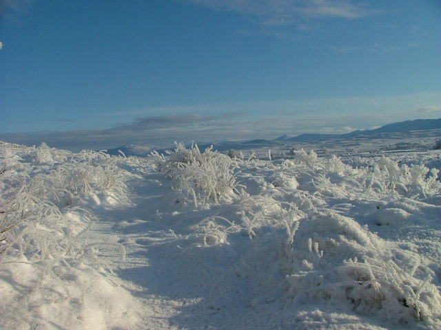
The western frontier of Rannoch Moor, unforgiving in winter, looking toward the east | Wikimedia Commons
Stage 1 data
| Total distance: | 12-15 miles |
| Travel time and days: | up to 15 hours travel time over 2 full days |
| Average miles per day: | 6—8 mpd |
| Average hours per day: | 6—8 hpd |
| Speed: | < or = 1 mph |
Stage 2: Hatching a plan, and the western leg
We’ll perhaps never know when or how the refugees hatched a specific plan to travel east, but if they were able to use a shelter that may have existed at one of the sites above, this could have given them some mental breathing room to think through their next steps. Was it here they decided on Aberdeenshire specifically, or just to figure out the best way to get the hell out of the Highlands alive? Maybe just heading east was enough for now.
Day 3
- 15 Feb: Rannoch Moor frontier to Dunan area | This is level ground, but until the refugees encounter a footpath north of Loch Laidon, they may be forging a virgin trail through boggy land. We know MacDonalds brought cattle here in the summer and stayed in temporary shielings, so they may have had some good local knowledge of high ground in this part of the Moor. Still, sluggish progress in a snowy landscape. We’re using Black Rock Cottage as Mile 0. Black Rock to Dunan or Couregannen is about 15 miles. Along the way, other possibilities include Invercomrie, Sluich, or Claggan. Slow going for 16 miles at Rate 2, 1.5 mph, a full 10⅔ hour travel day, one of the riskiest of the flat-terrain legs.

The Bridge of Gaur, approaching the Dunan area after leaving Rannoch Moor | Wikimedia Commons
Day 4
- 16 Feb: Dunan area to Dunalastair area | This leg would constitute one travel day from the west end of Loch Rannoch to the east. Kinloch Rannoch may be the first “civilized” settlement our refugees encounter, and even though they are on the lam, no one has yet heard of the Massacre to the west, so no one might suspect these travelers to be fugitives. It’s possible they are assuming false identities by now, and it’s also possible that having a bairn along makes them more sympathetic — though travel in winter with such along might seem odd to anyone who might be offering Highland hospitality. Remember, though, we have MacIain’s well-documented journey as precedent, so it’s not inconceivable.
Alternate stops
- If they stop in Kinloch, it’s a short travel day, which will make Pitlochry, the mid-point of the journey, hard to reach in 2 days; they’d need a pit stop in a place like Bohalich (on the Roy map, known as Chamberbanc on the OS Six-Inch, near today’s Strath Tummel).
- On the other hand, if they stop at one of the many settlements near Dunalastair — Roy shows about 9 including Tempar or Lassentalich, both of which are on today’s maps — Pitlochry is possible in 2 days. There is a path on this leg and it is dead level along the loch, but snow is still a factor, so we can assume Rate 2, 1.5 mph for about 12 miles for an 8 hour day travel to Kinloch, or 15 miles for a 10 hour day to the Dunalastair area.

A beach on the eastern end of Loch Rannoch, near Kinloch Rannoch. | Wikimedia Commons
Day 5
- 17 Feb: Dunalastair area to Pitlochry | Our cash-poor Highlanders may not have been able to afford the luxurious lodgings offered in a town such as Pitlochry, but if they could, this could mark a moment of relief, to rest in a bed, bathe, or eat a real meal. Alas, the amenities we see today are Victorian vintage; this was a tiny hamlet in the 17th century, if Roy’s map is any guide. Yet at minimum, at the mid-point of the journey, Pitlochry offers an opportunity to stock up on provisions and purchase or barter for things they need and may not have been able to bring. By now snow, while still inhibiting travel, is not the factor it has been, and this path is both level and adjacent to lochs and rivers, in a relatively well settled area, so we assume Rate 1, a “fast” 2 mph, making this 16 mile leg doable in an 8 hour travel day.

Loch Tummel inn, east end of Strathtummel, did not exist in the 17th century, but a settlement here is shown on Roy | geograph
Day 6
- 18 Feb: Day of rest (?) | Pitlochry is a logical place for a day of rest, as it’s the last town of any scale before they head up into the mountains, aiming north for Braemar. If not a day of rest, this may be an extra day of travel needed if conditions don’t permit the 16 mile slogs described above.
Stage 2 data
| Total distance: | 46 miles |
| Travel time and days: | up to 28 hours travel time over 3-4 days |
| Average miles per day: | 11.5—15.3 mpd |
| Average hours per day: | 7—9.3 hpd |
| Speed: | 1.64 mph |
Stage 3: Turning north
So far, after crossing Rannoch Moor, our refugees have simply had to parallel the River Gaur, Loch Rannoch, River Tummel, and Loch Tummel, barely registering a change in altitude (900 feet at the Moor compared to about 600 feet at Pitlochry) and effectively heading straight due east for a comparatively easy 35 miles. At Pitlochry, we experience a change in the general direction of the “grain” of ridges and valleys in the Highlands, and this makes finding a route continuing due east an impossible challenge. They have the option of moving south toward Perth or Dundee, or north into the high hills, skirting the untamable Cairngorms at Braemar.
This might have been another potential moment for a fateful decision. Should they continue on out of the Highlands altogether and aim south to the Lowlands, or should they head for a more easterly but safer part of the Highlands where they might blend in with a local population a bit better? Though the road was harder in the short term, they may have concluded there would be a better chance for success by sticking with what they knew, and what knew them, the best. To think things over, they may have taken a day of rest here, having traveled already about 60 miles in 5 or 6 days.
Moving through the passes that would lead north presented the most challenging landscape since leaving the Moor. To make it more feasible, they used drove roads that connected western Aberdeenshire to the markets at Crieff:
Day 6 or 7
- 19 Feb: Pitlochry to Spittal of Glenshee | The drove road on this leg is decidedly different in character from anything else these refugees have experienced so far. They bump intermittently into burns instead of keeping water as a constant companion, and the changes in elevation are more frequent and more pronounced. In this 16 mile leg, gently at first from Pitlochry to Enochdu, then more extreme at a turn in the road heading into the hills toward Spittal of Glenshee, they experience an ascent of about 1200 feet over 4 miles, followed by a 900 foot drop over the last 1.5 miles. Not exactly a roller-coaster, but taxing nonetheless. If our refugees found this landscape too intense for a 2 day slog, there are some places along the way to break it up into shorter legs taking more days; Enochdhu is a good candidate for a split. We’ll assign this leg a conservative Rate 2, 1.5 mph for a long 10⅔ hour day, doable if morning and evening twilight are used.

Right-of-way between Enochdhu and Spittal of Glenshee | geograph
Day 7 or 8
- 20 Feb: Spittal of Glenshee to Braemar | There has been a hostel at this site for centuries, functioning as a base camp for the wild Grampian mountains that separate it from the Dee river basin, but a standing stone testifies to the very ancient origins of a settlement here. It leads to an intense mountain pass landscape. Spittal of Glenshee’s elevation is about 1150 feet, and Braemar’s is about 900 feet, but in between the ascents and descents bounce and dance up and down around 2250 feet until it settles into the Clunie Water valley. A settlement like Newbigging (which shows up as unnamed structures on Roy) or Auchallader could be a lifeline on the second leg if Braemar turned out to be unattainable by twilight. The structures no doubt served as waysides for cattle drovers. This is a 14.5 mile leg at Rate 2, and we’ll assign 10 hours of time.

Cairnwell Pass, the highest altitude public road in the UK, winding from Spittal of Glenshee to Braemar. For the record, no snowplows or pavement in the 17th century… | Scotland Off the Beaten Track
Day 8 or 9
- 21 Feb: Day of rest | The party may have rested in Braemar after this tough hike, or may have taken an extra day to get through it all.
Stage 3 data
| Total distance: | 31 miles |
| Travel time and days: | up to 21 hours travel time over 2-3 days |
| Average miles per day: | 10.6—16 mpd |
| Average hours per day: | 7—10.6 hpd |
| Speed: | 1.5 mph |
Stage 4: The eastern stage
When the refugees reach the area around Braemar, which Roy calls Castletown and the OS Six-Inch labels Castleton of Braemar, they will have traveled 78 miles over the course of 7 to 10 days. It’s late February, somewhere between the 20th or the 23rd, and word of the Massacre may be spreading by now. They have been passing through areas controlled by friendly Robertson and Stewart clansmen, as well as Clan Gordon holdings, and they are now entering a land under the sway of the Clan Chattan Confederation, specifically Clan Farquharson.
Day 8, 9, or 10
- 22 Feb: Braemar to Ballater | The River Dee provides some much-needed relief from mountain passes and altitude changes. Like Stage 2, this a level, comparatively simple path heading due east. While a little more than 16 miles separate the towns, we’re assigning a Rate 1 speed of 2 mph to this leg, so the travelers are done with their day in about 8 hours.

Between Braemar and Ballater lies the famous Balmoral Castle, a mid-19th-century construction. In the 17th century, the estate belonged to Charles Farquharson of Inverey, brother of John Farquharson, the “Black Colonel”. The Farquharsons were Jacobite sympathizers involved in the 1715 and 1745 rebellions. Farquharson estates were forfeit after the uprisings failed. That this was Jacobite country no doubt was attractive to our refugees. | Wikipedia
Day 9, 10, or 11
- 23 Feb: Ballater to Aboyne | I can testify from direct experience of this area to the comparative ease with which our refugees could finish this last leg of their journey. Only 11.5 miles from Ballater, the Kirkton of Aboyne is reached at Rate 1, 2 mph, and ends the final day of the migration after less than 6 hours of travel. Charlestown of Aboyne, as it was then known, was a planned town to the west that may have already started to eclipse settlements like Kirkton of Aboyne. This may have been why our refugees were able to settle there.
Stage 4 data
| Total distance: | 28 miles |
| Travel time and days: | up to 14 hours travel time over 2 days |
| Average miles per day: | 14 mpd |
| Average hours per day: | 7 hpd |
| Speed: | 2 mph |
Migration summary
If we assume an escape the evening before the blizzard and Massacre of 13 February, we can estimate the entire journey could have taken anywhere from 9-11 days of travel time, **which would not include 1 to 2 days of possible rest as described above. If we include rest days, and start on the evening of 12 February, we can conjecture that the refugees arrived in Aboyne as early as 21 February and as late as 25 February:
Total migration data
| Total distance: | about 120 miles |
| Travel time and days: | up to 80 hours travel time over 9—11 days** |
| Average miles per day: | 10.9—13.3 mpd |
| Average hours per day: | 7.3—8.8 hpd |
| Speed: | 1.4—1.8 mph |
Conclusions
What we’ve been able to demonstrate in this post, backed by evidence from the previous two, is simply one thing: a migration from Glencoe to Aboyne was in fact feasible in the late 17th century.
What we cannot prove here is:
- The factual reality of this migration theory; there is no primary source record.
- The identity, surnames, or number of any actual refugees, save for the possibility that one may have been a young Peter Cromar.
- The exact route, stops times, or days; that is both unprovable and beyond the scope of conjecture.
Nor can this post provide insight to many questions:
- When and why did these theoretical refugees decide on Aboyne, instead of returning home?
- When and how did they decide on the alias Cromar?
- When they arrived in Aboyne, how were they received, and how did they assimilate into a new community?
- How did they pass the story on, such that we know something about it in three different places around the world today?
- What did their family back home think? Were the refugees presumed dead, bodies lost in the corries?
- Were there other instances of Glencoe refugees leaving and migrating elsewhere?
I don’t know that I’ll be able to tackle any of these questions. But then again, two years ago, I would not have been able to demonstrate the feasibility of our family oral history. Perhaps the future holds new answers!
Leave a Reply